Saturday, 3 August 2013

Triglav - Day 3 - Koca pri Triglavskih jezerih to Stara Fuzina

Today was mostly about descent... apart from the first bit - a nice steep scramble out of the 7 lakes valley. Beyond that we had a very pleasant stroll through several valleys and tiny alpine hamlets towards Lake Bohinj. We avoided any bad weather and although the slopes were often very steep, there was a very good path the whole way.

About halfway, we passed the entrance to one of the deepest caves in the area - some 900m deep. The narrow opening looked ominous. As we approached the lake for the final descent, we witnessed a group of paragliders taking off - it was an excellent spot for it, having such a steep slope and great views over the lake. We got to the town of Stara Fuzina for a late lunch, where we bumped into a group of British hillwalkers from a university group or something. We ate more hearty soup and dashed to catch the bus back to Bled.

A great outing in the Alps - I'd recommend it to any walker who is prepared for a little scrambling.

The entrance to a cave nearly a kilometer deep.

Stara Fuzina and Lake Bohinj.

A paraglider setting off across the lake.

Monday, 22 July 2013

Triglav - Day 2 - Dom Planika to Koca pri Triglavskih jezerih (via the summit)

I awoke full of anticipation and nervous energy at the thought of climbing what we'd heard to be a slightly tricky summit ridge. The conditions were perfect - bright sunshine and very little wind at 7am. We donned hard hats after crossing the first snowfield and then made our way across a mixture of snow and rock along the well marked trail. After about half an hour, it was clear it was about to get more tricky and exposed. Hilde turned back to the hut having a dodgy knee and not wanting to put it to the test in exposed conditions and I tagged along with a couple of Austrians and began the steep ascent of the side of the ridge.

I was very grateful for the fixed wire and metal stakes which lined most of the route from here on, without which it would certainly have been considered a rock climb. As such, it still wasn't a walk in the park, with a few tricky moves appearing without protection and some delicious exposure. Once on top of 'mini Triglav', the gradient eased, but the ridge was very much a knife edge often less than a metre wide at the crest. One short but quintessentially alpine snow bridge sticks in the mind. All this simply added to the exhilaration however, since at no point were the conditions dangerous or the moves beyond me - they were just continuous.

I reached the summit about 1hr15 from the hut and took a moment to absorb the stunning views and grab a few snaps. The summit itself was quite covered in snow, although thankfully the ridge hadn't been. I arrived at the same time as half a dozen others, so there was plenty of hand shaking and mutual photo taking before I decided to head back down the ridge. Care was obviously taken, but it was in descent that the fixed wire really became useful, making it easier than I had expected. The round trip to the hut took just under 2hr30.

After that we made our way to the Dolic hut for lunch. This was another high-level hut that had only just opened for the summer and whose running water was thwarted by the late snows. On the way we had to negotiate some steep snow slopes without crampons and plenty of traversing on snow and rock. None of it was particularly hard, but it required concentration and would have been easier in a month's time! Some of the rocky bits were great fun though.

After more 'vegetable' soup in the sun outside the hut, we traversed more snow slopes to a plateau before descending into the '7 lakes' valley. Our approach to the first lake was accompanied by thunder and although the rain never got particularly heavy, it was persistent enough to ensure we didn't dawdle too much around the lakes. It would have been nice to spend more time there, but since one of our rain jackets wasn't superb, we pressed on to the '7 lakes' hut, some 2 hours down the valley. This was a very cosy and jolly place, which was much needed to replenish our energy stores. It was also much busier, being at a lower altitude, with many people considering the climb up to Dom Planika in the less favorable conditions.

A panorama of the summit

The ridge on the left, with the Dom Planika hut on the right. 
The Vodnik hut is in the far distance on the snowline behind Dom Planika.

Atmosphere on the ridge - there are people on the ridge in the centre.

Hilde negotiating a steep rocky section en route to the Dolic hut.

Triglav (2864) - Day 1 - Rudno Polje to Dom Planika

We had the luxury of a lift from Mrs Marinsek to the trailhead on Rudno Polje, a plateau to the NW of Stara Fuzina and some 800m higher up. Our legs were very grateful, although there was still 1200m to go that day. The first half of this was in one go - through trees then up the side of an alp to a pass at 1875m. The climb took us past some patches of snow, which caused us a bit of worry about how much there might be further up, but the paths were good and spirits were high.

Next we traversed round a peak called Tosc to the Vodnik hut, where we received huge sandwiches and our first taste of 'mountain tea' - a delicious mixture of black tea with something like blueberries. The place was fairly busy, being a crossroads for people doing the ascent and people touring below the snowline.

We left there about 1pm and began the last steep section, which was sometimes rocky, often snowy and always ascending. Care had to be taken crossing the snowfields, given that it was now afternoon and the snow had gone quite slushy, but we managed without too much difficulty and without any specialist gear like crampons, etc.

As we approached the small barren plateau around the Dom Planika hut, there was a little bit of snow in the air and indeed no sooner had we got inside than a brief snowstorm whipped up to make us feel like we were on the edge of the world.

The hut had a stunning location and was quite cosy, although it was a bit dark and did suffer from still being partially snowbound early in the season - the running water wasn't yet available, since the well was still frozen over. Not to worry, we made do with red wine and a waterbottle of melted snow. A private room for two is luxury in the alps though and the vegetable soup was great (although I'm glad I'm not actually a vegetarian, since there were some quite obvious chunks of beef in it).

Panorama from the Vodnik hut. Triglav is behind the hut on the right hand side.

Triglav, 3000ft below the summit. Dom Planika is quite visible below 'mini Triglav' on the right.

A traditional scene in the Julian Alps.

Monday, 20 July 2009

Dufourspitze, day 3 and some tips.

The following day, we decided to opt for the 'late' breakfast at 7am and were heading back for civilization by about 9. The return was a bit more interesting, since the lower glacier had begun to weep and I only had one functioning crampon. Apart from a couple of cartoon-esque slips (accompanied by cartoonesque swearing - $%*&), we made it across in one piece and were back at Rotenboden within 3 hours.

We both encountered strange effects over the next few days. For a start, we were sunburnt - therefore we learnt to apply sunscreen and wear sunglasses for ALL of the daylight, not just the sunny bits. Seems obvious, but when there was complete cloud cover, we didn't think about it.

Ben felt a bit nauseous when returning to 1600m in Zermatt 24 hours after finishing the climb and then didn't want to eat anything - just sleep. I found a similar thing when we got to Geneva the next day, 48 hours and not much above sea level. I'm not quite sure what to read into this and it was nothing serious, but it seems the altitude can work both ways. Neither of us got headaches though, or any other problems apart from fatigue when on the mountain.

As far as our equipment was concerned, we took a little food, 2l of water each (too much, but probably would have been right in warmer weather), lots of warm clothes, gloves and hat which we wore most of the time, sunglasses+suncream (which were underused!), 50m rope and harness (30m would easily have been sufficient, but 50m was all we had - we tied double-figure-of-eight knots at 2m intervals to give friction if we fell off anthing), winter boots, crampons and ice axe (obviously essential) and headtorch (for before 5am). No specialist climbing gear or navigation equipment was needed, though I did have a belay plate, guidebook and GPS with me - all went unused.
A view of the upper reaches of Monte Rosa from the Breithorn. Dufourspitze is in the centre and our route follows the white 'S' shape below that.

Friday, 17 July 2009

Dufourspitze, day 2.

At 2am, we had to force down the food that would keep us going for the first couple of hours of ascent. By 2.40, after a suitable amount of faffing, we were all booted-up and were setting off up the path that we had rehearsed the previous afternoon. I think we were the last to set off from the hut - our two English chums were just ahead of us and there were also a group of 3 (a French couple with a guide, but we think they were actually attempting the twin peak, since we didn't see them further up until back at the hut in the evening) and a solo Italian (a lissom waif of a climber, who looked like he could slither up the most difficult of climbs and hand you a box of Milk Tray at the top) who proved his mettle by being far faster than the (slightly smug) Englishmen we had dined with. There were also a pair of Austrians, a group of 4 English Army guys and a group of 3 of unknown nationality who were all bivvying at about 3400m to get a bit of a head start and to take a non-negligible 600m of ascent out of the equation. A total of 14 attempting the peak, we think. The purpose of the diabolically early start was to give us the best of the snow conditions - it's much easier and safer to make good progress on hard snow and ice than the slushy stuff it becomes in the afternoon. Avalanches weren't likely to be a problem, but these also happen much more frequently in the afternoon (we did hear a couple of ominous distant rumbles caused by things falling off the steeper mountains in the area during the afternoon).

Putting on crampons at 4am

The first hour and a half of the climb was across rock and we had carefully calculated the optimal time to change from boots to crampons, which turned out to be the same spot as the guide with the French couple (winner!), but they then went off in another direction. It was at 3109m, where the snow started and there was a split in the path. We continued up snow which became glacier, following the distant lights of our guiding climbers. A little while later we roped up for safety, with about 20m between us and plenty of knots in the rope. As we crossed the first part of proper glacier at about 4.30am, we realised that two of the bivvying climbers had had a bit of a lie-in and were behind us and they followed us at a steady pace as light began to creep eerily across the wintry scene.

Dawn, looking back down to the valley base from about 3700m.

By 6am, we had covered about half of the 1800m of ascent, but that was definitely the easy half. Most of it was a plod up the hard-packed snow on the top of the glacier - the tracks were fairly easy to follow and there weren't many crevasses to negotiate. At about 4000m, we passed the last crevasse (called a bergshrund) and then the altitude began to make the going very slow. At this point we were about an hour and a half ahead of schedule, but this began to ebb away. 4359m marked the end of the glacier and the saddle at the start of the more technically demanding summit ridge. We were here by 9.30am, but for the rest of the climb I was needing to stop every 5 minutes for a breather - it was a strange kind of tiredness since my muscles didn't feel tired, but everything was an effort and nothing could be done quickly. Fortunately we didn't feel any nausea, delerium or headaches, so we knew we weren't suffering from 'altitude sickness,' but weariness was there in bushels and more for me than for Ben.

The bergschrund

As we reached the saddle, we were able to discuss the conditions with returning climbers. First 2 of the army guys came back, saying it was too windy on one of the snow bridges and they had turned back - this filled us with some trepidation. Then the Italian soloist strode by saying that the conditions were excellent and it was just a breeze - we were more encouraged, but suspected that he may have said this about an afternoon jaunt on the north face of the Eiger. The Austrians and the 3 of unknown (possibly germanic) nationality had also gone on a bit, dithererd and come back. I don't think we were ever in any doubt that we were going to give it a go, but this was making us a bit more edgy. As we began to climb the first snow tower, the other two army guys came down, followed by our English chums, the former saying (with wide eyes) that it was 'epic', but they had made it and the latter saying that it was fine, but that we should be careful with the wind. This was better news, so we began our slow plod up the snow tower - this was about 100m high and quite steep, but continual plunging of the ice axe made it safe and not too scary. The snow 'bridges' which linked parts of the ridge were just crests linking two tops with nothing to hold on to. The wind made them a bit tricky, but they were quite short and perfectly solid underfoot, so we felt safe (especially as we still had 10m of rope between us in case anything went wrong). We just went one at a time quickly across to the other side and then held on whilst the other came across. There was a rocky section of good scrambling, which was more what I was used to, so that was ok. Another 100m snow tower reared its head next, which we slowly reeled in and we then left ice axes at the top of this for the final rocky section. This was more good scrambling, but included a couple of sections of 'fixed rope' which were just thick bits of rope to haul oneself up on a couple of the more tricky bits. Without these I guess some parts would have been considered rock climbing, but such as it was there was nothing to worry us technically. The second fixed rope led us right onto the summit, which led to much rejoicing, dancing and other forms of sitting-down.

Looking back down the summit ridge - it is quite difficult to gauge the scale here, but the saddle is the notch roughly 1/6 of the way across the photo from the left, 1000ft below us.

The views of Nordend were dramatic, since the ridge is almost sheer on the east side. We could see other people on the top of nearby Zumsteinspitze and when the cloud permitted us, we could see the Margharita Hut on Punta Gnifetti, which is the highest building in Europe. We took the obligatory summit shots and rested for about 15 mins while we took in our achievement. By the time we left the highest point in Switzerland (and second highest in the Alps), it was about 11.50.

The ridge along to Nordend - the side you can see is the less steep side. We didn't climb this.

Zumsteinspitze with Punta Gnifetti behind.

The summit shot.

The climb was by no means over though and we still had to maintain concentration for the descent, but at least the physical effort should be reduced. It was fairly easy to maintain concentration for the scrambling back along the ridge, but once back at the saddle, I really began to struggle to keep the pace up due to altitude-weariness. This improved a little as we lost height, but was only replaced by genuine weariness.

Looking back at the summit ridge from just below the saddle

Despite this, we still made reasonable time back into the crevasse field, but by this time it was well into the afternoon, so the snow was rotten and crevasses a genuine problem (especially due to a short rain shower we had weathered). We tried to find a route across them, but had to turn round several times, only to realise we'd been on the right route in the first place. This cost us an hour or so before we could get back onto the last snowy rocky bit. It was then safe to de-rope and we made better progress. That was apart from one point, when I slipped on a piece of wet snow and my crampon caught on a rock, causing the crampon to break and me to cut my hand - that slowed us a bit more as I had to descend the snow in just boots and had limited use of one hand (it wasn't badly hurt, just tender).

Eventually we crawled into the Monte Rosa Hut at some point after 5, taking about 5hrs 30 for the descent - probably 2 hours more than it should've taken, but we were able to celebrate with a large beer and a warm meal. We were thoroughly pleased with our achievement, especially since we were 2 of only 7 to actually make it to the top.

Monte Rosa (Dufourspitze 4633.9m) day 1

From Zermatt, Ben and I got the Gornegratt railway up to Rotenboden, some 2818m above sea level. Since our destination, the Monte Rosa Hut, was only at 2795m this might seem like cheating, but it was a 3hr hike down onto a glacier and up a cliff to get there. Today we didn't even need crampons, since the glacier was quite dry and gritty, so our good winter boots were enough. We were constantly filled with trepidation about our impending climb, since our route was spread out in front of us and we had plenty of time to contemplate it. On a more positive note, we were also able to see the conquered Breithorn and some splendid views of the Matterhorn.

We got to the hut at about 11am (plenty of the day left to acclimatise) and found it all to be pretty civilised. Dinner was to be at 6.30 (Italian themed today - soup, salad, spag bol and meringue) and lights out at 10pm (far too late for us - we were in bed by 8), ready for breakfast at 2am. This left us several hours after arrival to scout out the beginning of the climb - we climbed up to 3500m, where the main glacier started - put on crampons and generally got a good (invaluable) feel for the first few hours which would all be in the dark. Over dinner we chatted to a couple of veteran british climbers from manchester who couldn't help name-dropping the Matterhorn amongst climbs they had done (they said it was easy). They were quite encouraging though, so we went to bed thinking we might be able to get to the top the following day. Sleep didn't come easily (for me at least) - I spent most of the few hours that we had thinking about how I would cope with the conditions - would I get altitude sickness, would we make it to the summit by midday (our turn around time), would the summit ridge prove too technically difficult? Eventually I did get an hour or so of sleep before the brutal 2am call came around....

The start of the walk to the Monte Rosa Hut

The view of Monte Rosa - the Dufourspitze being the right-hand peak.

The ever-present Matterhorn.

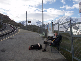
Rotenboden station

The Breithorn (4164m)

Sunday saw us waking at 6 to catch the first cable car up to the Klein Matterhorn. We actually ended up getting the second one, since there were far too many excitable small skiers around to make it worth pushing for a space. The string of three cable cars took us to over 3800m, so modern mechanisation makes a bit of a mockery of this once challenging peak. Still it suited our purposes by providing a training ground for some ice techniques and some much needed acclimitization (even if this was reached far too quickly in the cable car).

We were in the first batch of about 20 to start the climb and we began the trail across the glacier. The southern slopes that we approached were fairly featureless and just plain steep snow, so we just had to adjust our pace to suit the angle and plod on. We only had a total of about 400m to ascend, so after about an hour, we were reaching the east ridge - only then did it feel like we were on a mountain, not just some snowy playground, since the ridge narrows to a crest which is not more than a metre wide for a stretch of 100m or so. It was exhillerating to edge our way along this and when we reached the small summit, the views were stunning. We could see Mont Blanc and Gran Tourmalin in the far west, the Weisshorn in the north and the fine ridge along to Liskamm and eventually Monte Rosa to the east. We gazed in that direction mostly, since that was our objective for the following days.

Summit snap.

The Matterhorn from the top.

Along the ridge, with Monte Rosa in teh distance.

Looking back at the now swarming summit.

The only difficulty we found was the fact we had to move slowly with the altitude, but otherwise it was an ideal introduction. Due to our rapid ascent, we both found we had headaches for a few hours afterwards and when we returned to Zermatt we slept for a few hours in the afternoon - whether that was anything to do with the altitude I'm not sure, since I had had very little sleep the previous night.